

North Dakota's Remote Trail Has Been Ranked One Of The Top '100 Hikes Of A Lifetime'
We may receive a commission on purchases made from links.
Of all 50 states, North Dakota is among the least traveled. While its southern counterpart attracts tourists with Mount Rushmore and Crazy Horse, North Dakota is much more remote, with only 14% of Americans having visited the state, according to a 2025 YouGov survey. Perhaps this is a kind of "save the best for last" approach; North Dakota is filled with stunning places and terrain, including the largest national grassland in the United States. Little Missouri National Grassland covers over 1 million acres in western North Dakota and is home to much of the renowned Maah Daah Hey Trail, which, along with the Algonquin Trail in Upstate New York, has been featured in Stephanie Pearson's 2026 book, "100 Hikes of a Lifetime U.S.A."
Getting its name from the Mandan language, Maah Daah Hey roughly means "an area that will be around for a long time." The original 96-mile trail officially opened in July 1998 and gained international recognition by 2001. By 2013, the trail had become overgrown and difficult to traverse properly, prompting Save Maah Daah Hey, a local nonprofit, to step in and restore it. In 2014, the trail system was expanded southward, adding another 47 to 48 miles along a pathway called "The Deuce." This brought the route to its current 144 miles.
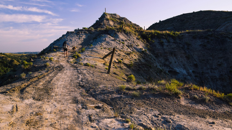
Today, the trail stretches from Burning Coal Vein Campground in the south to CCC Campground in the north, passing through some of North Dakota's most stunning landscapes. Along the way, hikers can explore open prairies, rugged canyons, steep peaks, and panoramic views of the Little Missouri River. Visitors can hike, mountain bike, and even ride horses through this remote landscape. Maah Daah Hey features several connecting trails, 17 trailheads, 11 campgrounds, and various landmarks, all waiting for nature enthusiasts to discover the beauty of North Dakota. Medora, roughly two hours west of Bismarck, makes a convenient base for exploring portions of the trail.
Exploring Maah Daah Hey Trail by foot or bike
In addition to the 144-mile Maah Daah Hey Trail, the system includes several shorter trails ranging from 0.3 to 18.9 miles, with varying difficulty. Some, like the 18.9-mile Buffalo Gap Trail, skirt the underrated Theodore Roosevelt National Park, which is full of wildlife. With so many miles to cover, many hikers split the trail into shorter segments to make it easier to manage. Your experience can vary depending on which trailhead you enter through, so it's recommended to pick up a map from a local Dakota Prairie Grasslands office or download a trail guide online to see exactly where you're going.
Along the Maah Daah Hey Trail, you can push your limits at Devil's Pass near mileposts 100 and 101, a narrow route with a 150-foot drop-off on each side. While this used to be the main road through the area, it is now a popular destination for a day hike with some of the best views along the route. Visitors can explore the ice caves near mileposts 108 and 109, as well as an impressive clay formation known as the China Wall between posts 128 and 129. Hikers also have the potential to spot wildlife such as bison, grazing horses, and bighorn sheep.
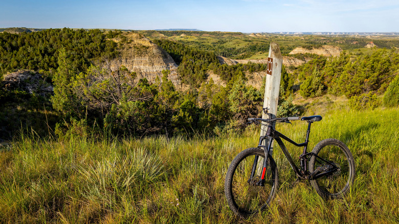
Maah Daah Hey Trail might be great for hiking, but it's also a major draw for mountain bikers. In fact, the trail has received an EPIC designation from the International Mountain Biking Association (IMBA), recognizing its challenging backcountry riding experience, something "many mountain bikers live for and make travel plans around. Maah Daah Hey also received the 2022 Bicycling Travel Award for Best Hidden Gem in the United States. The pathway is designated for non-motorized use, so vehicles such as e-bikes, all-terrain vehicles, and snowmobiles are not permitted.
Camping along the Maah Daah Hey Trail
Nature lovers who are fiercely independent can tackle the entire trail on foot, typically taking a week or longer to complete it. Thankfully, the larger Maah Daah Hey Trail system includes 11 campgrounds, conveniently spaced 20 miles apart along the trail, so the opportunity to rest is never too far away. Many Forest Service campsites cost $10 per night and feature a picnic table, fire ring, and seasonal drinking water. Cottonwood Campground, in the South Unit of Theodore Roosevelt National Park, is the largest campground in the trail system, with 76 total campsites. Many campsites are available on a first-come, first-served basis, though Cottonwood now requires reservations. Several campgrounds are open year-round, although services may be limited during colder months. Because of blistering-hot prairie summers and frigid, windy winters, May through June and September through October are generally more comfortable times to visit.
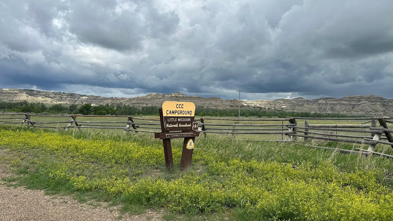
If you are looking to stock up on food and necessities before the hike, you can visit the town of Medora, which is full of unique character right outside a National Park. Roughly 30 miles south of town is Burning Coal Vein Campground, which marks the southern end of the trail. This eight-site campground is one of the most remote, offering vantage points of the surrounding badlands and a sprawling pine forest. As you go along your hike, depending on your pace, you can stop at campgrounds such as Elkhorn and Bennett to rest for the night and enjoy a quiet evening in western North Dakota. Upon completing the trail in the north, you'll reach the CCC Campground, which has recently been remodeled and expanded, with 38 camping spots for guests.