

Not Zion, Not Glacier: This National Park Has America's Steepest Cliff
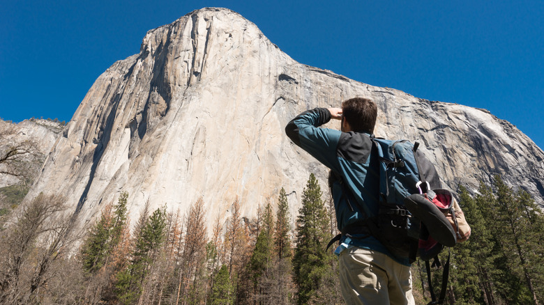
Zion, Utah's first national park, has the monumental sandstone canyon walls surrounding Angels Landing. The Continental Divide runs through Glacier National Park, the "Crown of the Continent," where steep mountain slopes dominate the landscape. But when it comes to sheer, towering cliffs in the U.S., few can rival the gigantic granite monolith El Capitan. Located in Yosemite National Park, the 3,000-foot-high and one-mile-wide, virtually vertical cliff face is famous the world over, especially among the climbing community. Climbers arrive from across the globe to ascend its unforgiving walls each year, which, at more than twice the height of the Empire State Building, is no mean feat.
Formed around 100 million years ago, El Capitan started life as molten rock deep beneath the Earth's surface. Over time, tectonic forces pushed these rocks upward, but it wasn't until the glaciers carved their way through these granite walls that Yosemite Valley and its sheer cliff faces took shape. The Ahwahneechee people, who have long called Yosemite Valley home, called the formation Tutokanula. Its present-day name dates to 1851, when the Mariposa Battalion entered the valley as part of a campaign to forcibly remove its Native inhabitants. Battalion physician Dr. Lafayette Houghton Bunnell helped give it the name El Capitan.
The near-vertical cliff was once thought unclimbable, but is now the holy grail of rock climbing, with over 100 routes up its steep face. Warren Harding, Wayne Merry, and George Whitmore completed the first ascent of El Capitanvia the route known as The Nose in 1958. There have since been countless successful climbs, and if you're looking for inspiration, watch the documentaries "The Dawn Wall" or "Free Solo," the story of Alex Honnold, the first person to ascend El Capitan with no ropes or protective equipment in 2017.
Hiking El Capitan
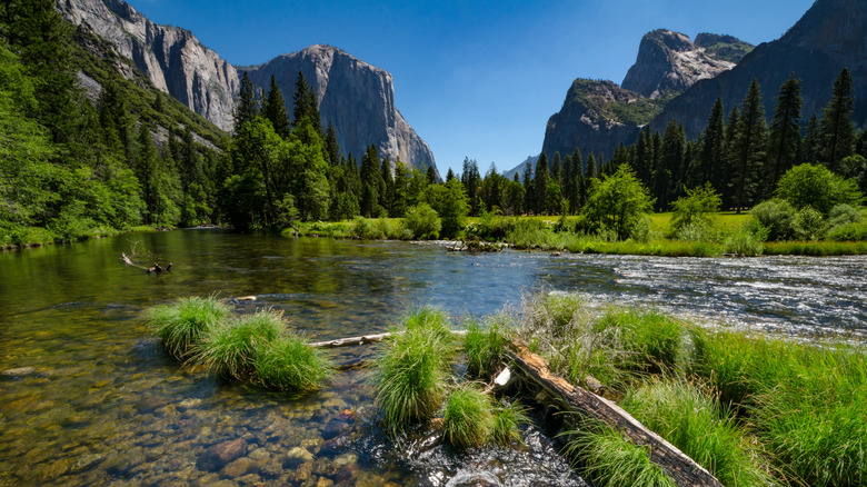
Fortunately, you don't always need ropes or nerves of steel to reach the summit. You can get there via the El Capitan from Yosemite Valley Trail. Unsurprisingly, this is a strenuous, difficult hike that covers around 15 miles round trip, with an elevation gain of over 4,600 feet. You'll need to make an early start, too, and allow a full day to complete it. Starting near Camp 4, the route begins on the Yosemite Falls Trail, which rises by way of a series of switchbacks through oak woodland and past one of North America's tallest waterfalls. Here, you have the choice of adding a detour to Eagle Peak, or you can continue climbing to the top.
While the trails are well marked, loose gravel and sand can make it slippery, and caution should be taken, especially on the way down. Sturdy hiking boots, a map, and plenty of water are a must, and if you're planning to camp overnight in the wilderness, you'll require a permit. Conditions also depend on the time of year, with snow sometimes lingering into late spring. Don't be surprised if you see the odd bear on the way, either, but be sure to keep your distance.
For those who would rather tackle the route with a guide, Lasting Adventures offers guided day hikes to El Capitan from April to November, with prices starting at $800 for one or two people as of this writing. However you make it to the top, no description of the views over Yosemite Valley will match the reality. An easier, flatter alternative is the Yosemite Valley Loop Trail, with the option to do the full 11.5-mile loop or the 7.2-mile half loop. You may not get the views from the top, but you still get to appreciate the scale of this granite giant from directly below.
Where to get the best views of El Capitan
If you're familiar with the work of Ansel Adams, finding the best views of El Capitan may be your main objective. The famous photographer spent a lot of time in Yosemite, and his photographs of its epic landscapes are celebrated worldwide. Some of the best close-up, full-face views are from El Capitan Meadow in Yosemite Valley, accessible from Shuttle Stop 9 on the free Valleywide Shuttle. It's a good place to look out for climbers, so pack your binoculars. Further along, enjoy the views over lunch at El Capitan Picnic Area, accessed from Shuttle Stop 8.
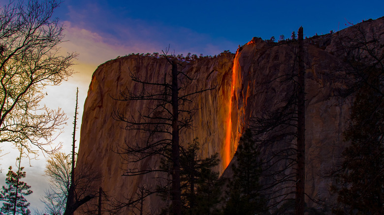
You'll need a vehicle for the view from Bridalveil Straight, where there are several pull-outs to stop and admire El Capitan on the left and Bridalveil Fall to the right. A must-do if you only have one day in Yosemite is Tunnel View on Wawona Road, which also looks out over Half Dome and Bridalveil Fall. The views are vastly different depending on the season, while subtleties in the light change with the time of day. Arrive around February, and you may see the Yosemite Firefall from designated viewing areas near El Capitan Picnic Area. This extraordinary natural phenomenon happens when the setting sun lights up Horsetail Fall as it flows over the eastern edge of El Capitan, creating the illusion of a cascade of fire. Never guaranteed, it requires clear skies, enough water in the fall, and the sun to be at just the right angle.
Camp 4 is the closest campsite to El Capitan and, along with Upper Pines in Yosemite Valley, is open year-round. Reservations are required for Camp 4 from April until November, and released one week in advance, but you can reserve Upper Pines five months ahead. You'll find a comfier bed for the night as well as plenty of dining options at Yosemite Valley Lodge, also in Yosemite Valley.