

California's Former Army Base Is Now A Vast National Monument With 86 Miles Of Trails
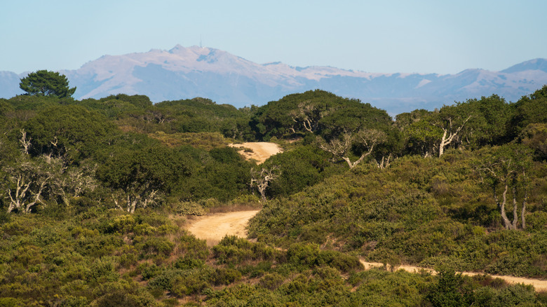
A former U.S. military base, once one of the country's main training facilities, isn't the first place you'd associate with a national monument. But the federally protected landscape covering more than 14,000 acres in Monterey County, where some of the best California beaches are located, has turned out to be an unexpected and ideal spot for hiking, cycling, horseback riding, and wildlife watching. Located between Monterey Bay and the Salinas Valley, Fort Ord National Monument is one of the largest remaining expanses of open space in the area. Most of the buildings have gone, and the grasslands, oak woodland, and rare maritime chaparral, a thick undergrowth consisting of manzanita and California lilac, are slowly taking over.
More than 1.5 million soldiers trained at Fort Ord, from its beginnings in 1917 until its closure in 1994, with troops preparing for conflicts in WWII, Korea, and Vietnam. In 2012, former President Barack Obama designated Fort Ord a national monument in a bid to protect the ecologically diverse landscape and its wildlife while honoring the generations of soldiers who trained there.
Despite more than 86 miles of trails to explore, there are still some restricted areas, where the military continue to clean up landfill waste, petroleum leaks, and unexploded mines – hence the importance of keeping to the designated trails. There are two main entrances to Fort Ord National Monument, which is open from dawn until dusk. Both Creekside Terrace Trailhead and Badger Hills Trailhead are accessed from Highway 68 between Salinas and Monterey, a must-see destination on a West Coast road trip. While it's easiest to reach by car, the nearest airport is in Monterey, around 10 miles away.
Fort Ord National Monument trails
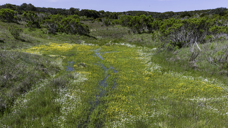
The 86 miles of trails running through Fort Ord cross through open grasslands, maritime chaparral, oak woodlands, wet meadows, and seasonal vernal pools, attracting wildlife like the protected California tiger salamanders. Wildflowers bloom in the open grasslands, changing color throughout the seasons, from the colorful hues of the Contra Costa goldfields in late spring, to the purple nightshade in late summer. Making themselves at home in this environment are bobcats, coyotes, California badgers, and mountain lions — here's what you should do if you cross a mountain lion while hiking – while vultures and red-tailed hawks patrol the skies.
AllTrails currently lists 24 trails within the monument, and a 4.5-mile section of the Juan Bautista de Anza National Historic Trail crosses Fort Ord between the Creekside Terrace and Badger Hills trailheads, following the route more than 200 Spanish colonists took in 1776. The 5.9-mile Guidotti, Skyline, Oil Well, and Toro Creek Loop takes you through open grasslands strewn with wildflowers, and on a clear day, you'll have great views of the Pacific Ocean. As a bonus, you may cross paths with the goat gangs, casually grazing and doing their bit to help prevent wildfires. The 2.7-mile Trail 1, Trail 72, and Trail 31 Loop provides a nice contrast, passing through forest and wetlands.
As attractive to cyclists as it is to hikers, Fort Ord is a hugely popular destination with the cycling community. The biggest event is the Sea Otter Classic, an internationally known, family-friendly cycling festival held at nearby Laguna Seca each April. For those who prefer four legs to two wheels, horses too, are welcome.
Exploring around Fort Ord
Besides the trails, there isn't much in the way of buildings to interest visitors on site. There are, however, some interesting places to visit nearby. Following the military theme, Fort Ord Station Veterinary Hospital in Marina is worth a detour, if only to witness a largely forgotten chapter of U.S. army history. The listed building was built in 1940 and is the only surviving example of its kind from the days when horses and mules were still used for military service. It didn't last long; only two years later, vehicles replaced horses. Plans are in motion to turn the site into a museum, but for now, be content to follow the Cavalry Trail from the hospital toward Fort Ord and Comanche's Grave. Comanche was the beloved white mustang who belonged to a retired cavalryman known as Old Bill. An interpretive display sits beside Comanche's gravesite recounting his life.
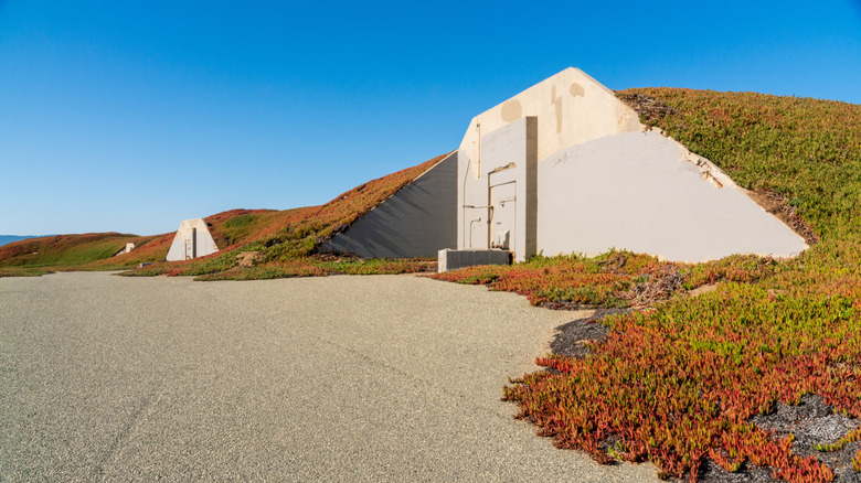
Also in Marina, stretching 4 miles along the Monterey Bay shoreline is Fort Ord Dunes State Park. Also once part of the military base, this section is managed by California State Parks. A few trails meander among the sand dunes in this 1,000-acre park, and as well as beautiful ocean views over Monterey Bay National Marine Sanctuary, there are still some remnants of army life left among the dunes. Download the self-guided cell phone tour to find the bunkers, former firing range, and the former site of popular soldiers' club Stilwell Hall, long since demolished.
While there's nowhere to camp at Fort Ord, a new 98-site campground is currently under construction and should be open in 2027. In the meantime, head to the Laguna Seca Recreation Area Campground which, as well as being next to a car-racing circuit with several events held throughout the summer, also has direct access onto Fort Ord's trails.