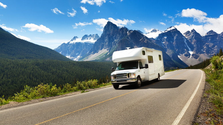
The Secret Web Tool RVers Swear By To Save Gas And Spare Your Brakes On A Road Trip
Recreational vehicle (RV) living is on the rise with the entry of Millennial and Gen-Z buyers enthusiastic to take to the road and travel the country. According to a survey by the RV Industry Association, the median age of RV owners is steadily getting younger, with nearly half of RV owners surveyed falling into the 35 to 54 year age range. First time RV owners account for around a third of the overall number, and Millennial and Gen-Z RV owners exhibit higher average use of their RV throughout the year compared to other age groups. It's no surprise then that RVers are taking to technology and the Internet to plan out their road trip adventures to optimize efficiency.
One secret web tool RVers swear by to help save gas and spare your brakes on the road — and thus help maximize your budget on an RV road trip – is called Flattest Route. User fly_1 wrote about it in the RV Life forum. It's a free route calculator that's extremely easy to use. The site helps road trippers find the route that avoids big obstacles that could take up time — and spend gas — such as large mountain ranges or small roads where you have to drive slower and potentially climb up higher. It can also help you find the most consistent route, so you can navigate those higher elevations without fear of sudden steep grades or other rapid elevation changes. Also a favorite of cross-country bikers, this site aims to make your road travels as stress-free as possible and helps you plan a successful RV trip through sometimes-challenging terrain.
How to use the Flattest Route website
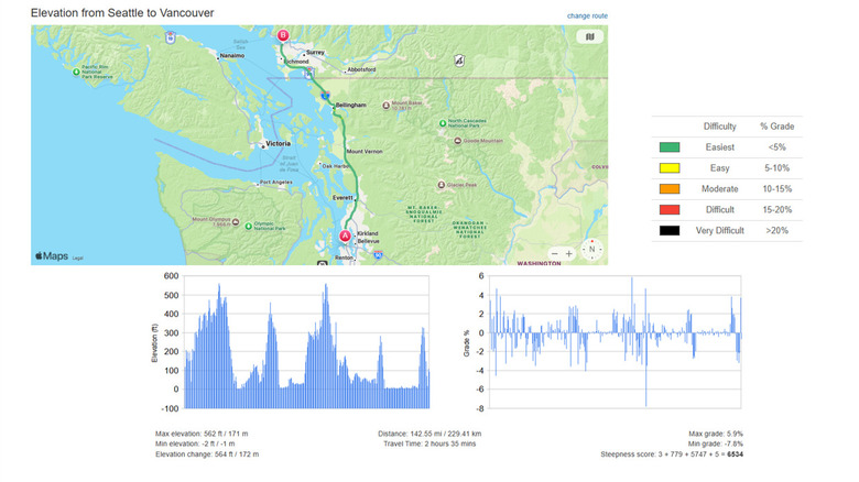
When you pull up the Flattest Route website, you'll be prompted to enter your starting and ending cities. Hit "go" to calculate the route, and it'll generate a color-coded map (as in the image above). The map not only highlights the flattest route, but also visually codes what parts of the route are easy or difficult. A corresponding color key outlines difficulty levels, with black illustrating "very difficult" (meaning a 20% grade or more) and green being the easiest (less than 5%). Hopefully, the route it calculates is predominantly green. If not, then you know that even the flattest route has some steeper climbs.
Scrolling down, you'll notice another set of charts that outline the elevation spread and grade changes along the route. These provide visual breakdowns of when and where you can expect to encounter changes of elevation. Underneath the charts, it lists what the maximum and minimum elevations are, what the overall elevation change will be, the distance of travel, and the expected time the drive will take.
Another feature of the site is the ability to crowdsource information from users who submit tips about the route outlined. At the bottom of the page, there's a text box prompting users to write in thoughts if they've driven there before. Here RVers can help spread the word about an obstacle, like a landslide blocking a road or a bridge down for maintenance. Overall, this tool is fantastic to use with your regular navigation devices, to ensure you're optimally planning out your trip and not burning through tons of gas quickly or wearing your brakes down prematurely. Great for those Millennials and Gen-Zers getting out on the road for their first RV trip, it'll become a staple in your planning routine.