South America Is Home To The World's Southernmost Hiking Trail Known For Unmatched Views
If you're a hiker and a fan of extremes, there's a trail just for you. In the rugged terrains of the Chilean part of Tierra del Fuego lies an adventure into some of the wildest realms of nature. The Dientes de Navarino, or the Dientes Circuit, boasts the title of the world's southernmost trekking trail. Far from busy cities and crowded tourist spots, the Dientes Circuit offers unmatched views and an incredible opportunity to immerse oneself in the raw beauty of the Earth's most remote landscapes.
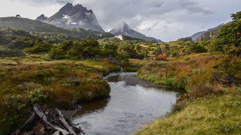
The Dientes Circuit wraps around the tooth-like peaks of the Dientes de Navarino mountain range on Navarino Island, near the town of Puerto Williams. Spanning roughly 33 miles, this trail can take between three to five days to complete, depending on the pace and experience of the hiker. The trail's elevation and terrain vary dramatically — from the jagged peaks that give the circuit its name, resembling the teeth of a great beast, to the many serene lakes that mirror the Patagonian skies.
Tackling this hike is not for the faint-hearted. The subantarctic climate in this region can be extreme, with unpredictable sunshine, rain, snow, and fierce winds. Navigation is difficult, with the trail sometimes becoming less distinct, demanding a good sense of direction and experience with navigation tools. But if you're looking for an underrated destination where you can explore Patagonia without the crowds, this is it — a journey of isolation, offering few signs of humanity beyond the trail markers that guide the way.
The Dientes Circuit journey
To be one of the 2,000 people who take on the Dientes each year, you'll have to brace yourself for a rugged and rewarding journey. The original five-day route was developed by Clem Lindenmayer in the 1990s for a trekking guide — the map can be found here. The first day will begin in Puerto Williams and end in Laguna del Salto. On the way, you'll encounter Cerro Bandera (a mountain with stunning views of the Beagle Channel), a Magellanic forest, and Laguna del Salto.
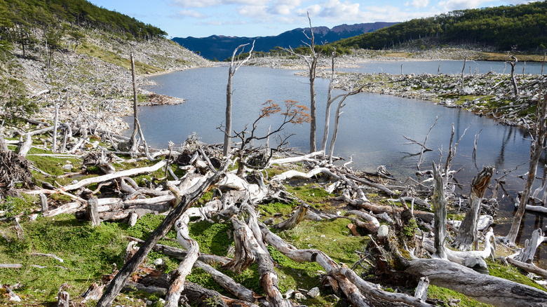
The day one route is mostly done by day-trippers, but day two really takes you into the circuit with the Paso de los Dientes mountain pass and a trio of beautiful lakes. Day three is Beaverland. Why? 60,000 of these tree-munching animals have taken over Navarino, and signs of their masterful engineering (and destruction) are everywhere. You'll pass by beaver ponds and dams, along with non-beaver features like streams, cliffs, and lenga forests.
Day four will take you to Paso Virginia, the highest point on the trek. Going down the pass is not easy: Think loose rocks and snow. The day's end will be at Laguna Los Guanacos. Finally, day five: From the scenic lake, you'll cross Beaverland zone once more and begin to descend through forests, daisy fields, and bushy slopes, to end at a northern road at Estero MacLean. Along this coastal road, a two-hour walk will lead you right back to where you started, Puerto Williams.
Preparing for the trek
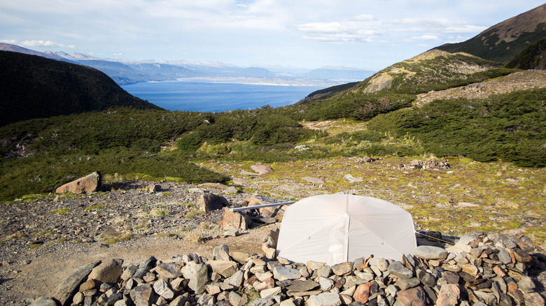
For those drawn to the Dientes Circuit and the stunning views it offers every step of the way, preparation is key. The trek requires good physical condition, tactical hiking gear, and the ability to be self-sufficient in a remote wilderness setting. This is an expedition in the truest sense — there are no accommodations along the way, so hikers must bring camping supplies and food for overnight stays. It's recommended to carry a map, a compass, and a GPS for navigation.
All trekkers must file their trip with the Carabineros de Chile at the police station. You'll have to provide all of your information, including your expected return — and when you do, indeed, return, let them know. Local guides are strongly recommended for those unfamiliar with the terrain. Hiking in this South American region is dangerous, especially because rescues are notoriously complex. Adventure Life, Explora Isla Navarino, and other providers offer itineraries that include nearly everything you would need for your Dientes de Navarino journey.
The best time to trek is between mid-December and mid-March. The rest of the year, the weather can be too savage, and the trail is effectively closed between May and October. To reach Puerto Williams in Chile, the starting point of the Dientes Circuit, you can either take a 45-minute flight with DAP Airlines or take a much longer, albeit more scenic, 32-hour ferry with Transbordadora Austral Broom — both of these options depart from Punta Arenas. World's southernmost hiking trail in Chile? ¡Vamos!