Picturesque Waterfall Adventures & Hiking Trails Await At Arizona's Mountain Destination
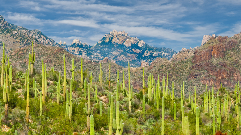
Nestled in the Santa Catalina Mountains on the northeastern edge of Tucson, Arizona, is the stunning Sabino Canyon. An outdoor nature spot that perfectly blends desert beauty with gorgeous canyon scenery, this destination is a great location for lovely hiking trails, beautiful waterfalls, and outdoor adventure. It's a must-visit spot for those seeking a true desert escape without the crowds of more popular Arizona spots, like the Grand Canyon.
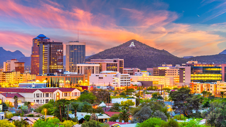
This nature escape is just over a 30-minute drive from Tucson's city center and less than a one-hour drive from Tucson International Airport. This makes it a great choice for those visiting Tucson looking for an outdoor escape that doesn't involve a long drive. Since there are no convenient public transport options to get to Sabino Canyon from other parts of Tucson, most visitors arrive by car or ride-share.
Sabino Canyon Recreation Area is extremely visitor friendly, with an on-site visitor center and a bookstore where guests can buy maps, gifts, and souvenirs. One-time entrance fees are just $8 per vehicle, and annual passes are available for purchase at the visitor center for $40 if you plan on visiting often. While onsite, you can even take a narrated Sabino Canyon shuttle tour, which costs $15 for adults, $8 for children aged 3 to 12, and is free for infants.
Waterfalls, wildlife, and trails at Sabino Canyon
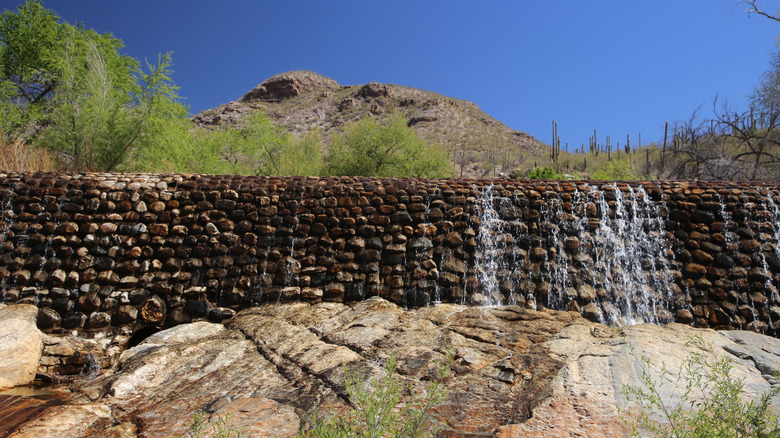
Sabino Canyon Recreation Area is packed with trails, suitable for all fitness and experience levels. One of the most popular routes is the moderately challenging Bear Canyon to Seven Falls Trail, a 3.5-hour hike that passes a series of breathtaking waterfalls, water levels permitting. Even when there isn't much water flowing in the falls, it's still a breathtaking hike through the rocky, cactus-studded wilderness.
If you're looking for something a little easier, the 2-mile family-friendly Sabino Walkway Loop takes less than an hour to complete and passes near picnic areas and waterfalls (when water levels are high enough) with stellar canyon views. No matter which route you choose in Sabino Canyon, be sure not to break this important cactus rule to avoid getting poked. And look out for desert wildlife, like hawks, jackrabbits, javelina, white-tailed deer, and if you're lucky, maybe even an elusive bobcat or mountain lion.
For those looking for continuing adventures beyond Sabino Canyon, there are many more superb hiking areas near and in the Santa Catalina Mountains. For one, check out Catalina State Park, only a 40-minute drive from Sabino Canyon. This state park sits at the base of the mountains and is a scenic area filled with canyon and desert views.
Plan your outdoor escape to Sabino Canyon
Regarding when to schedule your trip, the weather in Tucson is warm and sunny during most of the year. But know that summers in the Sonoran Desert are very hot and dry, which can make long walks in Sabino Canyon both risky and unpleasant. If you visit during monsoon season between July and September, though, water should be flowing in the canyon, creating inviting swimming holes that are perfect for refreshing dips. In particular, check out the swimming spots around Sabino Sam, Hutch's Pool, and The Crack.
While there are no lodging options within the canyon itself, there is a great selection of places to stay nearby. The city of Tucson offers everything from budget hotels (rates starting at around $60 per night) to luxury resort-style accommodations. The historic four-star Hacienda Del Sol Guest Ranch Resort is one outstanding option. It's just a 20-minute drive from Sabino Canyon and boasts a tranquil desert setting, an exquisite swimming pool, and award-winning dining experiences.
This part of the Southwest is also perfect for winter camping adventures. You can't camp right in Sabino Canyon, but you don't have to venture very far to find a place to pitch your tent. For example, the aforementioned Catalina State Park has 120 sites for tent and RV camping, and horses are even welcome here, too.