

This Hiking Trail Along Lake Tahoe Connects Two Of California's Scenic State Parks
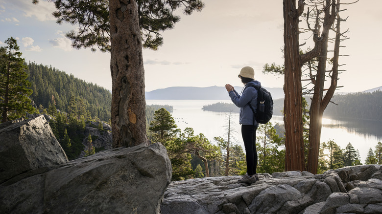
Why choose between the ancient forests and hidden coves of D.L. Bliss State Park and the swimming beaches and rocky coastline of Emerald Bay State Park when you can enjoy them both? Taking a meandering path along the western shoreline of Lake Tahoe, the Rubicon Trail links both of these scenic California state parks, giving panoramic views over one of the world's biggest, deepest, and clearest lakes, its stunning turquoise waters framed by the distant peaks of the Sierra Nevada.
Not to be confused with the Rubicon off-road trail through the Sierra Nevada, this popular hiking trail follows granite headlands that rise above the lake, passing through old-growth pine forest on one of Lake Tahoe's most unspoiled stretches of shoreline. Accessed from either park, the trail, which sits at a lofty elevation of more than 6,000 feet, is a moderate hike with some strenuous uphills. As you make your way along the picturesque pathway, a Scandinavian-style mansion, a historic lighthouse, and the lake's only island are just a few of the landmarks you'll see peeking out from behind the trees. Emerald Bay State Park is arguably the best base for exploring Lake Tahoe, and is located around 9 miles from South Lake Tahoe, and roughly an hour and a half from Reno, which is home to the nearest major airport, Reno-Tahoe International Airport.
Hiking the Rubicon Trail
While the Rubicon Trail can be accessed from either end, some hikers recommend walking from north to south, starting at the Rubicon Trailhead in D.L. Bliss to make the most of the views as you approach Emerald Bay. But if you start at Eagle Point Campground in Emerald Bay, you'll not only get the steepest climbs out of the way first, you'll finish at the quieter Lester Beach, one of Lake Tahoe's best beaches.
The trail takes you along dirt paths, occasionally following the woody scent of Jeffrey pine and incense cedar through sections of the forest. There are large granite rocks and steps, but most of the trail keeps to the shoreline, so you have near constant views across the water as it changes from bright turquoise to cobalt blue. You may even catch sight of the odd osprey diving for fish.
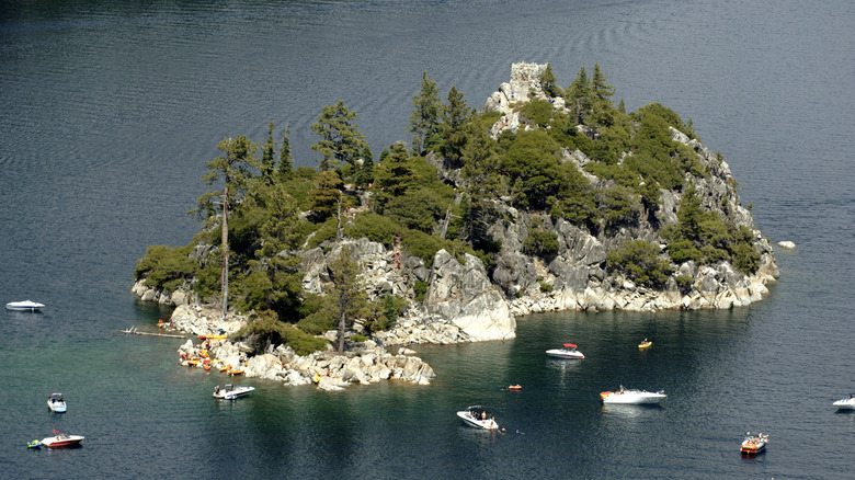
Some of the most scenic viewpoints along the way include Vikingsholm, a Scandinavian-inspired mansion on the shores of Emerald Bay. If you time it right, you could take a guided tour around the beautifully preserved building, which is listed on the National Register of Historic Places. The tiny building you can see offshore on Fannette Island, Lake Tahoe's only island, used to be a tea house belonging to Vikingsholm's owner, Lora Josephine Knight, who used to entertain her friends there during the late 1920s. You can see the remains close up if you paddle over there from Emerald Bay, except in April and May. If you like history, take a short detour to Rubicon Point Lighthouse. The small wooden tower has been out of service since 1921, but it was once the highest-elevation lighthouse in the U.S. and is worth visiting if only for the view.
Planning your visit to the Rubicon Trail
To walk the Rubicon Trail from north to south, head to the Rubicon Trailhead in D.L. Bliss State Park. There's also the Lighthouse Trailhead a little further down. But if you're starting from the Emerald Bay end, you can either access the trail from Eagle Point Campground parking lot, or head a bit further up to Vikingsholm Parking lot. Because of these different access points, there's often some confusion over the trail's length, but California State Parks list it as 7.4 miles between D.L. Bliss and Eagle Point. Unless you're hiking it as an out-and-back trail, you'll need to arrange transport for when you've finished. Many hikers opt to take two cars, one for each parking lot as the Emerald Bay Shuttle doesn't go to D.L. Bliss. Parking costs $10, but spaces fill up quickly, so you really need to arrive early.
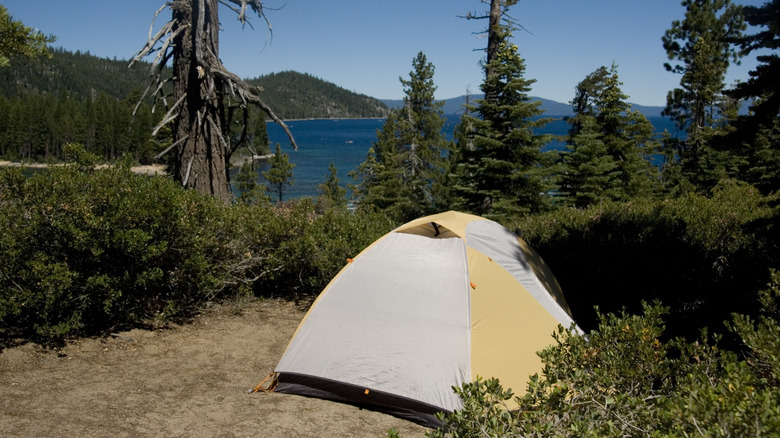
The Rubicon Trail is technically open year-round, but for practical reasons, it's best to visit from May through October. Heavy snowfall causes roads to close over winter and makes some sections of the trail inaccessible. But during the summer, the blissful surroundings make it a pleasant spot for camping. On one side you have the D.L. Bliss Campground, which can be reserved and is near the trail. On the Emerald Bay side, there's Eagle Point Campground, which places you close to Emerald Bay shoreline. If you're planning a stay at Lake Tahoe, try the Emerald Point Trail for more jaw-dropping views, or you could hike up Mount Tallac for a different view over its deep blue waters.