Hike To An Iconic Rock Formation In This California National Park For The Best Views
More than just beautiful beaches and amazing weather, California boasts some impressive mountain terrain to entice hikers and nature lovers alike. About an hour and a half east of Fresno, Sequoia National Park is one such place. With its countless scenic vistas, ancient caves, and towering trees in the Giant Forest (the largest in the world, in fact), this park draws in more than one million visitors per year. But you don't have to be an experienced hiker to appreciate the natural surroundings. The Moro Rock Trail is one popular and simple way to take in an epic view.
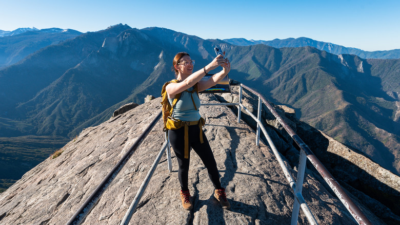
As you enter the park, it won't be difficult to spot this giant slab of granite. The rock formation sits at an elevation of 6,725 feet above sea level, formed millions of years ago by molten rock that cooled and eroded into the shape of a dome. The first known ascent was by the Native Americans who called the area home. In 1858, members of the tribe introduced the treasure to a man named Hale Tharp, who built a cabin in the area. By the 1930s, a public trail was constructed by the Civilian Conservation Corps, making it easier for hikers to reach the top than ever before. Thanks to their handiwork, the short, steep climb starts just a quarter of a mile from the summit, yet it supplies the kind of rewarding view that makes you feel like you just scaled the whole mountain.
What to expect on the Moro Rock Trail
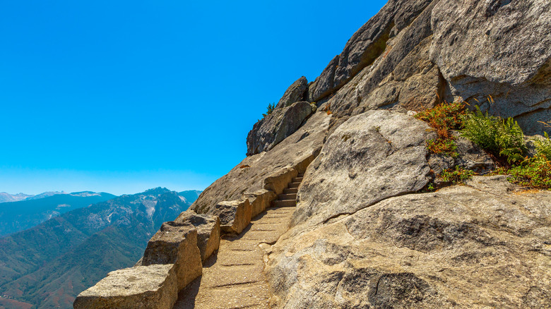
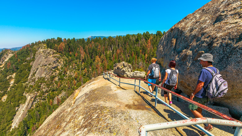
You'll start your adventure with a road that switchbacks up the mountain, taking you about 30 minutes away from the park entrance. It won't be long before Moro Rock looms into view. Though it bears resemblance to Half Dome in Yosemite National Park, the trek to the top is far less strenuous. From start to finish, the entire trail is 350 stairs over the span of a quarter mile. It's challenging enough to get your adrenaline pumping while still being manageable to complete in about an hour and a half.
There are safety rails in place to guide you up the mountain, offering some measure of comfort when you look over the edge and see the steep drop to the side. In some places, the trail narrows to fit only one hiker at a time, but it's always secure. When you scale 250 feet uphill and reach the top, you'll get to enjoy a panoramic view of faraway peaks and the valleys and forest below. To the west, you'll spot the Kaweah River and the snaking road you took to get to the trail entrance. To the east, you'll find an expansive view of the Great Western Divide, a subrange of the High Sierras.
Tips to know before you go
The fee to get into the park costs $20 if you arrive via public transport, $30 if you show up on a motorcycle, or $35 if you bring your car. During holidays and the summer high season, visitors can park down the mountain and take a free shuttle to the trailhead, as parking lots fill up before noon. While the route is family-friendly, it's best to leave Fido at home for this one, as dogs are not allowed outside of the park's accommodations or campgrounds.
One of the best tips to plan your trip is to check the weather beforehand. With the steep incline and metal railings, it's best to avoid Moro Rock during a storm, especially when lightning is involved. Plan your hike on a day with a clear forecast. Though the visibility will be half of what an explorer might have seen in the 1800s (thanks to the pollution from cities in the Central Valley), it's still a breathtaking view from the top.
As one of the most popular hikes in Sequoia National Park, it's best to get to Moro Rock as early as possible, preferably during the week. The view is also stunning around sunset, but be sure to bring a headlamp or flashlight so you can get down easily. While you're up there, don't forget to look up at the stars and catch a glimpse of the Milky Way Galaxy. This is a whole other side of California you've never seen.