

California's Former Army Base Is Home To An Original Cold War Radar Tower With 360-Degree Views
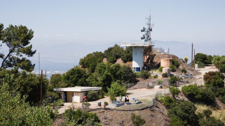
When you think of U.S. military history or a visit to the USS Midway Museum or the March Field Air Museum, you probably don't connect it with a vacation in the great outdoors. And while historic landmarks like these are fantastic tourist destinations for history buffs, they don't conjure up images of winding hiking trails and scenic views. However, a surprising number of decommissioned Army, Navy, and Air Force sites have been converted into parks and reserves, and California's San Vicente Mountain Park is arguably one of the best.
California is particularly blessed with amazing outdoor spaces reimagined from old military sites. Orange County Great Park in Irvine, for example, was once Marine Corps Air Station El Toro, a blimp base. Fort Ord Dunes State Park in Marina was once a base that trained roughly 1.5 million soldiers over its history. But San Vicente Mountain Park is one of the state's most charming former-military parks. Located just outside Los Angeles, the base was a Nike-Ajax supersonic anti-aircraft missile launch site during the Cold War.
San Vicente Mountain Park is situated in the eastern Santa Monica Mountains, near Topanga State Park, one of the best hiking destinations in California. It's around half an hour north of Santa Monica and 45 minutes northwest of central Los Angeles. Easily accessible via Interstate 405, it covers just over 10 acres of what was once land owned by the U.S. Army. Here's why it's worth a visit if you're looking for an outdoor getaway with a glimpse into history.
Cold War history and views at San Vicente Mountain Park
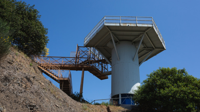
By the end of the 1950s, there were 16 surface-to-air anti-missile sites in Southern California, designed to protect the U.S. from the potential threat from the Soviet Union. Most of these have long since disappeared, but one, Nike Missile Site LA 96C, remains (decommissioned, of course), and has been transformed into a delightful mountain park, with some truly stunning panoramic views over Los Angeles.
This particular site was meant to guide anti-aircraft missiles launched from nearby facilities with its radar and detection systems. The site's original Cold War radar tower has been preserved as the centerpiece of the park. Visitors can park near the Upper Canyonback Trailhead, take a 10-minute walk on a wide dirt path, climb the radar tower, and enjoy astonishing 360-degree views of Los Angeles and the Santa Monica Mountains.
Alongside the hike and the views, visitors will be able to learn a little about the history of the Cold War through a series of interpretative displays and signs dotted around the radar tower. The site was built to coordinate responses from other anti-missile sites in the area in the event of a ballistic attack. It's a great way to combine a day out in the open air with an interesting, educational experience. Plus, it is located on an unpaved section of Mulholland Drive, which has unmatched nighttime views of Los Angeles and is one of the best places in the city to watch the sunset.
A hiking haven close to the city
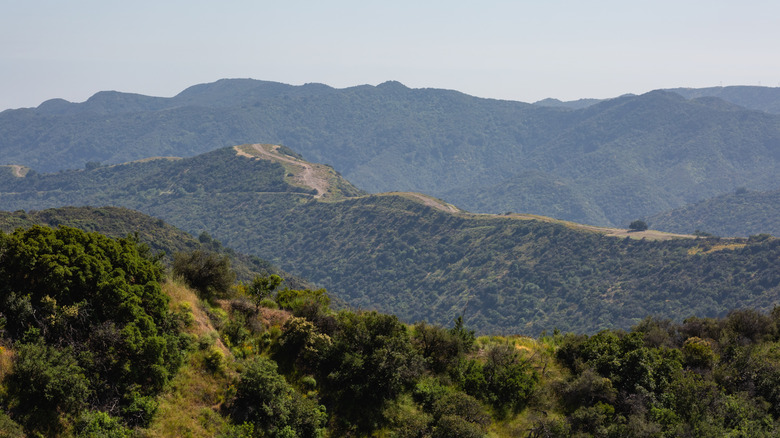
California's Santa Monica Mountains are an exceptional place for hiking and climbing, as they offer plenty of challenges and stupendous landscapes while also being close enough to the city to be convenient. If you want to add more exploring after a visit to the San Vicente Mountain Park, there are more than 500 miles of amazing trails to choose from, with plenty of options for every level of hiker.
The West Mandeville Fire Road and Ridge Trail is a great place to start. This easy out-and-back route from Mandeville Canyon Park covers nearly 4 miles with some gentle elevation, decent terrain underfoot, and beautiful vistas of the San Fernando Valley. If you are looking for something a little more adventurous, the Goat Peak via High Point and Rivas Ridge Loop takes you through the dense forest of Rivas Canyon, with some seriously steep uphills and some stunning viewpoints over the Pacific Ocean and downtown LA.
Serious hikers might want to take on the challenge offered by the Eagle Rock and Temescal Peak Loop Trail. This classic Southern Californian route offers incredible terrain and scenery over 7.5 miles, from fire roads to rocky single tracks, including oak groves, grassy ridges, and the eponymous Eagle Rock, a dramatic sandstone outcrop overlooking the hills near Santa Monica Bay. It's a tough route that usually takes at least four hours to complete, so bring enough water, food, and sun protection.