

Not Yosemite, Not Glacier: This National Park Has The Highest-Elevation Scenic Drive
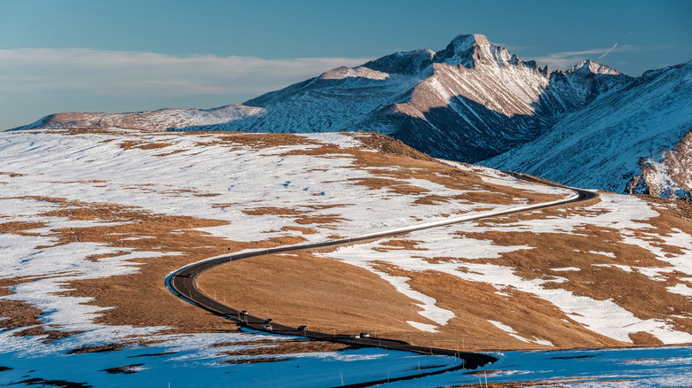
Road trips over mountain passes are among the most epic adventures you can have in your vehicle, and a few of these routes are located in U.S. national parks. Glacier National Park has the spectacular Going-to-the-Sun Road, which reaches a height of 6,646 feet as it skirts Logan Pass. Yosemite's Tioga Pass is even higher, attaining an elevation of 9,945 feet in California's rugged Sierra Nevada. But one stretch of park pavement soars above all others on the list, and if you're ever in Colorado, you shouldn't miss it: Rocky Mountain National Park's dazzling Trail Ridge Road (U.S. 34), the highest continuous paved road not just in national parks but in the country. The 48-mile trip along Trail Ridge Road starts in Estes Park, Colorado, and climbs to more than 12,000 feet before descending to Grand Lake, a town with heavenly Rocky Mountain views.
I'll never forget the first time I completed this journey, shortly after moving to Colorado from the prairies of the Midwest. After leaving the park's lower-elevation meadows, the road climbed thousands of feet through evergreen forests and past the tree line into the tundra — a patchwork of green, gold, and snow stretching out in all directions, occasionally rising to meet jagged peaks. On every horizon stood more foothills and mountains, including massive Longs Peak, which I would climb a few years later: my first of many Colorado 14ers (the term given to Colorado's 14,000-foot peaks).
Trail Ridge Road was my initiation into the grandeur of high alpine landscapes, paving the way for a lifetime of loving mountains. It was also one of my first experiences in Rocky Mountain National Park, an underrated Western park offering incredible outdoor adventures. Here is everything you need to know to plan your own adventure on this legendary road.
Best stops along Trail Ridge Road
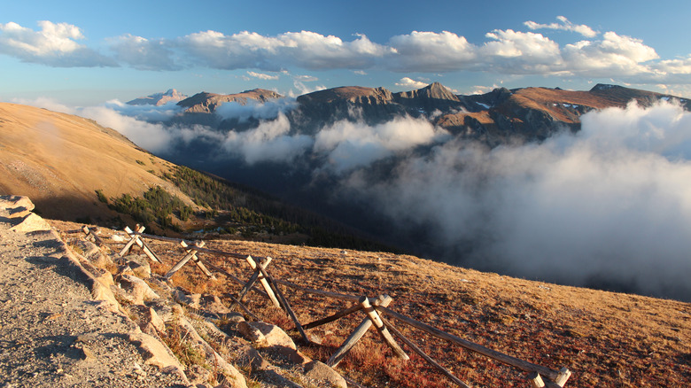
For the most dramatic and diverse views along Trail Ridge Road, consider these stops between the Beaver Meadows Visitor Center near the road's eastern Estes Park terminus and the Kawuneeche Visitor Center near the western terminus at Grand Lake. After leaving Beaver Meadows, the road ascends around 8 miles to Many Parks Curve. Stop here for a sweeping overview of the park, with views of its sole 14er, Longs Peak, as well as opportunities for amazing sunrise and sunset photography.
Around 7 miles down the road is the Forest Canyon Overlook, with views of an enormous glacial valley dotted with shining alpine lakes. Look out for the squirrel-like marmots here — rotund and adorable balls of fur that live among the rocks. From here, it's another couple of miles to Rock Cut and the mile-long Tundra Communities Trail. Grab your jacket and embark on this short journey for an introduction to the surreal tundra ecosystem. One hiker on AllTrails described the scenery here as like "something out of a JRR Tolkien novel." Another 2 miles beyond Rock Cut, Lava Cliffs offers a rare glimpse into the volcanic activity that occurred in this area 28 million years ago.
From here, it's 2 more miles to the Alpine Visitor Center, the highest-elevation visitor center in the National Park System at 11,796 feet. Stop here for interesting educational exhibits, bathrooms, refreshments, and souvenirs before descending to Milner Pass, 4 miles down the road. Here, you stand right on the Continental Divide, the line separating the continent's Atlantic-draining lands from western, Pacific-draining ones. Descend another few miles to Farview Curve for views of the Kawuneeche Valley, the Never Summer Mountains, and maybe even elk, which frequent the area, especially in early autumn. The next 14 miles of road wind down through the Western Slope's serene landscapes before reaching the Kawuneeche Visitor Center, with opportunities to stop for picnics and hikes along the way.
Planning your adventure on Trail Ridge Road
When planning your trip, keep in mind that the route is open only when it's free of snow, which varies from year to year but is usually from late May or early June through October or early November. However, the optimal time to do the drive is from the end of July through early September, when colorful wildflowers bloom on the tundra and wildlife such as elk, bighorn sheep, marmots, and pikas are most active. Even in summer, the weather in the mountains can deteriorate quickly, and it can be up to 20 degrees Fahrenheit cooler at the road's highest elevations compared to elsewhere in the park, so be sure to bring warm clothing with you in the car! Allow 2 hours or more to complete the one-way trip from Estes Park to Grand Lake, as you'll want to make stops along the way.
Beyond Trail Ridge Road, do at least a few hikes to experience it on foot, and, time permitting, consider an overnight backpacking trip for full immersion in its alpine wonders. I have done many backpacking trips in the park, but my favorite was along the Timber Lake Trail, on the greener west side of the Continental Divide, with one of the most magical meadows and lakes I have ever seen. The memory of a herd of elk quietly grazing in this meadow at twilight, bathed in golden light, is forever seared in my mind. The trailhead for this adventure is actually located on Trail Ridge Road, around 12 miles north of Grand Lake.
Rocky Mountain National Park is an hour-and-a-half drive from Denver, which has an international airport (DEN). Reaching the park from Denver requires driving through Boulder, one of America's best college towns and a must-stop destination if you haven't been there before.