Arizona's Remote Navajo Nation Scenic Byway Overwhelms Visitors With Its Rugged Beauty
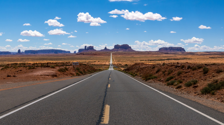
When people hear the words "red rocks," a few things may come to mind: a certain famous amphitheater literally called Red Rocks, the Grand Canyon, or maybe just the impressive rouge-colored stone formations along many Arizona desert roads. Tse'nikani "Flat Mesa Rock" Scenic Byway offers plenty of the third. Its rich, red rock formations are just one natural element that flanks this 41.6-mile stretch of U.S. Highway 191. Designated as one of Arizona's many scenic byways in 2005, the road boasts a rich and complex history intertwined with the Navajo Nation in which it exists, traveling through four of the sovereign tribal nation's 110 chapters: Many Farms, Mexican Water, Rock Point, and Round Rock. That history lives on today, with some byway travelers occasionally witnessing traditions like sheep herding playing out in real time. Visitors will also spot works of Navajo art that carry generations-old Indigenous practices and inspiration from local merchants.
Visitors traveling along Tse'nikani must understand that history. Before embarking on the journey, be aware that this scenic byway remains home to many members of the Navajo Nation, and visitors should treat it as such. Before venturing off the highway, ensure that you're entering with full permission (and in some areas, necessary permits), and never photograph residents without consent. Approaching your journey with context and respect, you can fully enjoy one of the most scenic road trips in America.
From canyons to wildlife, enjoy Tse'nikani's many wonders
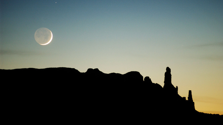
From start to finish, the roughly 45-minute drive along Tse'nikani Flat Mesa Rock Scenic Byway offers visitors more than just vast desert landscapes. First, there are the aforementioned red rock formations, often referred to as hoodoos. Travelers can spot them throughout the journey, with some of them more famous than others, such as the pair of formations called Dancing Rocks (also known as Whale Rock). The formation's Navajo name, Tsé Biná'ookaahí, references arrows shooting over the rocks. The sprawling lands and deeply hued mesas and buttes, visible from every angle of the byway, arguably offer one of Arizona's most underrated gems: a unique trifecta of terrain, history, and nature.
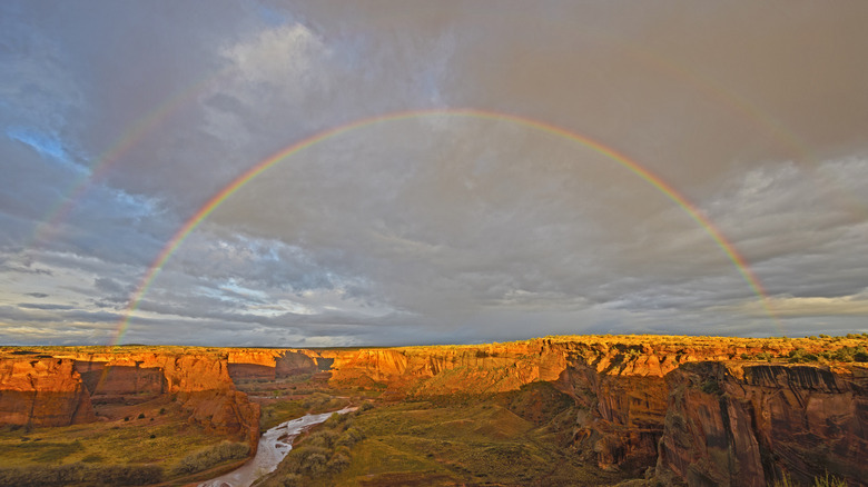
Turn onto Indian Route 7 to reach the Canyon de Chelly National Monument, which boasts deep canyons and expansive overlooks along hiking routes or scenic drives, as well as Navajo-guided tours on horseback. The monument offers a closer look at the history of the area surrounding the scenic byway, serving as an archaeological preservation site for numerous agricultural practices employed by the Ancient Puebloans, the Hopi, and the Navajo over hundreds of years.
The Tse'nikani Scenic Byway corridor area is also home to a diverse array of wildlife, depending on the location. Desert scrubs and grasslands surrounding the main highway section are home to the rarely spotted mountain plover, prairie dogs, and multiple snakes and lizards. Not all wildlife may be visible from areas of the corridor that are open to the public; always proceed with caution and be mindful of natural habitats.
Planning your journey to and along the Tse'nikani Flat Mesa Rock Scenic Byway
The Tse'nikani Scenic Byway's remote nature is part of its appeal and contributes to its well-preserved landscape. It also makes it slightly trickier to travel to, depending on your origin. The closest international airport is Albuquerque International Sunport, a three- to five-hour drive away depending on route and traffic conditions. Slightly nearer is Cortez Municipal Airport, which is about a 75-minute drive from the byway's northern point and offers flights from select airport hubs via the airline Denver Air Connection.
While there's little-to-no lodging directly along the scenic road route, visitors can choose from several hotels, motels, and inns in the areas surrounding it. The highly-rated Desert Rose Resort & Cabins is just over a 30-minute drive from the byway's northern point, offering a range of accommodations between $150 and $250 per night, depending on the season. Campsites also abound, some within the Canyon de Chelly National Monument, offering visitors the opportunity to camp in a gorgeous desert. Tseyi' Dine' Heritage Area — Cottonwood Campground (TDHA) is one such option, available with a service fee of $5 per day and parking cost of $20 per night. Always check campground websites for availability and amenities.
Visitors can drive along the byway any time of year, but depending on the activities you want to pursue while you're there, consider seasonality. Temperatures can vary significantly in the summer and winter, with average highs in the 90s in July and lows in the 20s during the colder months. For that reason, spring and fall might be the most ideal times to enjoy the corridor's outdoor recreation. If you're limited to traveling during summer and winter, prepare for the weather conditions, especially if you plan to camp during these seasons. Bring necessary protective gear, such as layers, sunscreen, and plenty of food and water, as nearby vendors are scarce.