What It Really Takes For A Novice Hiker To Summit The Highest Mountain In The Lower 48 States
Mt. Whitney isn't your typical mountain. You would think that the tallest peak in the lower 48 states would be in Colorado — where 58 mountains rise over 14,000 feet — or at least somewhere in the Rockies. But no, Mt. Whitney is in California's Sierra Nevada mountain range. You might assume that Whitney, with a total elevation of 14,505 feet, would be impossible to climb without ice axes and ropes; there is definitely a "hard way" to ascend the mountain, known as the Mountaineer's Route, but Whitney is generally considered "non-technical," especially in summer, when the snow has melted away. A regular trail leads up the mountain and, in theory, any hiker who is fit and prepared can just walk to the top.
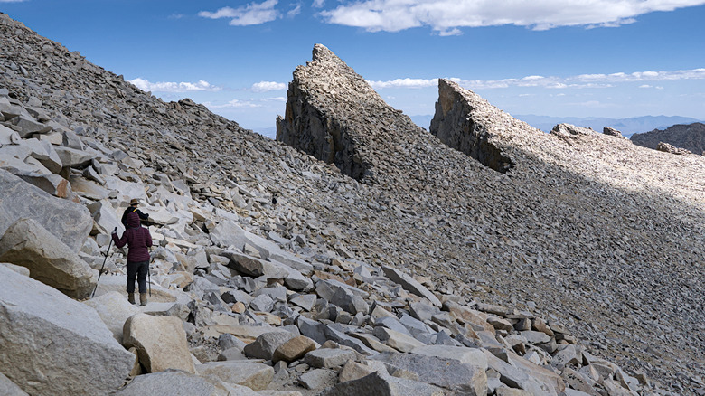
Still, Mt. Whitney is a rigorous climb, with 6,663 feet of elevation gain. The total there-and-back trek is about 22 miles, taking between 12 and 14 hours. This expedition poses several challenges to the novice hiker, including long drives, special permissions, an arid landscape, and bears, to name a few. Mt. Whitney's upper reaches aren't a national park but an actual wilderness area, which means following strict rules. If you're an aspiring alpinist, Mt. Whitney is a reasonable testing ground for basic skills, such as backcountry camping and use of a bear vault. It's also less popular than, say, Mt. Bierstadt or Quandary Peak in Colorado, which attract tens of thousands of visitors each year. You could easily add it to a list of must-visit destinations around the world for avid hikers.
Mt. Whitney permits and transportation
Mt. Whitney's trail system gets smothered in snow during the winter, so most hikers wait until summer to make their attempt. To prevent hordes of hikers from clogging the trails, the U.S. Forest Service uses a lottery system to grant permits from May 1 to November 1; this boils down to pure luck, so don't make firm plans before you've been notified. You can enter the lottery between February 1 and March 1, and the results will be announced on March 15; you then have about five weeks to confirm that you're definitely going to enter the wilderness area and to pay the $15 permit fee. Note that Whitney is part of a broader jurisdiction called Inyo National Forest.
If you score your permit, you'll then have to transport yourself to this remote location. The nearest major airport is Harry Reid International in Las Vegas, Nevada, about four hours away by car. The highway will take you on a winding route through Death Valley National Park; the pavement is smooth but steep, and summer temperatures routinely climb to well over 100 degrees Fahrenheit, so be careful not to overheat your engine. Eventually, you'll arrive in Lone Pine, a mountainous California gem that deserves a spot on your small-town bucket list.
Lone Pine is a great place to start your journey: This community of 2,000 residents has accommodations, restaurants, and its own Museum of Western Film History, which pays tribute to the hundreds of movies shot in the immediate vicinity. You can see Mt. Whitney, along with a vast wall of other mountains, from almost anywhere in Lone Pine, and it looks close by. Don't let your eyes deceive you, though; the trailhead, known as the Whitney Portal, is actually 11 miles away.
Hiking to the top of Mt. Whitney
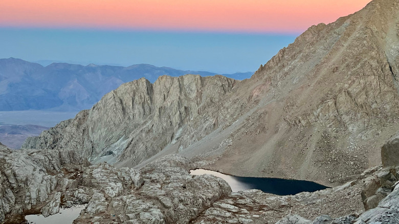
You can hike Mt. Whitney in a single, long day, but many visitors divide the experience into two days; you should decide this all ahead of time. The wilderness area has a strict "leave no trace" policy, which means you can't start a campfire, there are no trash receptacles, and all human waste must be packaged and removed from the area. Inyo National Forest is very dry, so you'll either have to carry sufficient amounts of water or bring a dependable filter and draw from the mountain lakes.
The route itself isn't very steep, thanks to sophisticated trail-building, and the most difficult part is the "99 Switchbacks" segment, which requires hikers to zigzag up the slope. Those switchbacks are designed to keep the trail as level as possible, so summer visitors won't have to scramble or climb up the slope. The biggest concern here is the elevation; the air gets very thin as you approach the top, and visitors may get short of breath, dizzy, or experience full-on altitude sickness. If there's even a hint of a summer storm, turn around; several deaths on the mountain have been caused by lightning strikes.
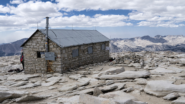
There are two campgrounds on Mt. Whitney, so you can spread the experience over two days. Once you've reached the top, you'll find a stone cottage and marker. Like all mountain climbs, getting back down is just as important as summiting, so give yourself plenty of time to descend. And once you're back at your car, you're only an hour from Bishop, which kicks off California's most scenic trail for beer lovers.