Hikers On The Pacific Crest Trail Will Face An Extra Challenge At The Canadian Border In 2025
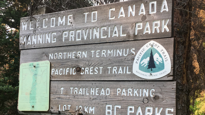
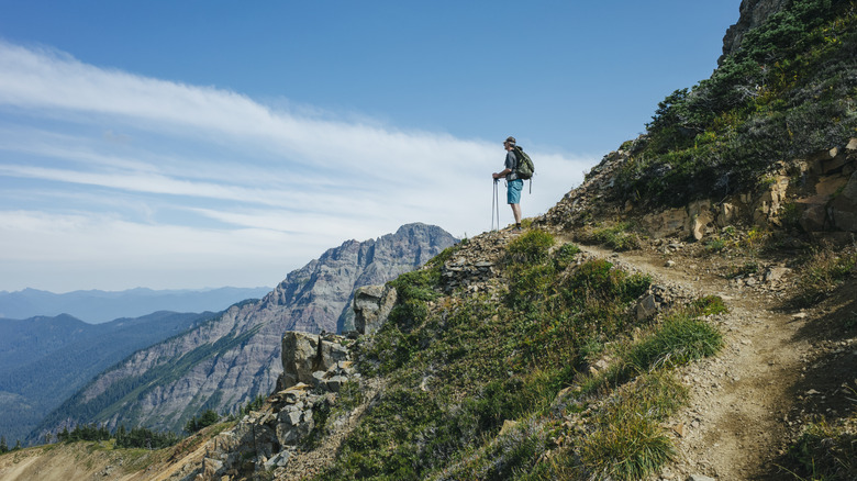
The end is near. You have already hiked at least 2,650 miles of the Pacific Crest Trail, and you're within 10 miles of the official endpoint. You can't believe you've walked so far, and soon you'll set down your backpack for the last time, knock back some water, and let your achievement sink in. Fewer than 11,000 people are confirmed to have walked the full length of the PCT, a popular West Coast trail that is easily considered one of the longest hikes in America, and your name will soon be entered on that special list. All you have to do is trudge a few more miles, to a wooden monument that marks the northern terminus.
But there's a problem: You have reached the Canadian border. Until recently, you could apply for a special permit to keep hiking down the trail, leaving only a few miles between you and E.C. Manning Provincial Park, which is right next to where the monument is located. In early 2025, the Canadian government ended that permit program, and hikers can no longer legally walk the PCT directly from U.S. to Canadian soil. Hikers are still invited to cross the border, of course, but they must do so at an official point of entry. This likely means tracking down a car and driving three hours east to the town of Nighthawk, Washington, or else driving four hours west to Sumas, Washington. There's a border crossing in each location, but then you'll have to double-back to Manning Park, which will take another few hours from either direction. This is clearly a hassle for hikers who just want to finish the journey on their own two feet.
The PCT's complicated international status
In promotional materials, people love to tell you that the PCT extends from Mexico to Canada. The reality of this statement is a little more nuanced: Nearly all of the PCT lies within the United States. Only about 10% of this route cuts through private land, and the rest consists of national parks and wilderness areas managed by the U.S. federal government. More than 90% of PCT hikers head south to north, starting at the Mexican border — but note that the PCT doesn't extend into Mexico. The southern starting point is about 1.5 miles south of Campo, California, where a second monument stands a few paces of the border wall.
The PCT does enter Canada, but not very far; the final leg is about 8 miles from trail-border to monument, which is a tiny fraction of the full route. To then backtrack 30 miles — which will take even seasoned hikers a couple of extra days — will feel anticlimactic at best. It's hard to imagine then tracking down a car and driving across large swathes of Washington State and British Columbia, passport in hand, in order to reach a small landmark.
Meanwhile, no such permit was ever issued for PCT hikers heading into the U.S. For that small percentage of outdoorspeople who wanted to start at the northern terminus and head south, directly crossing the border was always illegal. Even Canada's special PCT permit program required applications in advance, and it was suspended for three years in response to COVID-19. Meanwhile, as political tension built between the two nations in early 2025, Canada was among countries to issue warnings about travel to America.
What should a PCT hiker do?
Lots of thru-hikers just stop at the Canadian border. They can forfeit those last eight miles, content to have crossed the entire country, and in the most scenic way possible. E.C. Manning Park boasts spectacular mountain scenery, but it's no grander than the mountain ranges you've already passed through, and after at least 420,000 feet of elevation gain, you may decide to spare your knees the extra strain. Granted, no one likes to turn around and go back, and 30 miles is an obnoxious distance to keep walking, but if you know from the beginning that this is a price you'll have to pay, you may get used to the idea 2,650 miles later.
Purists may also front-load this task, by starting in Canada and venturing south. You can hike the eight miles to the U.S. border, then hike the eight miles back on the very first day. Then you can find a ride to an official entry point, enter the United States, and (again) hike to the Canadian border, this time on the U.S. side. This is a mostly symbolic gesture, but you'll at least have covered every inch of designated trail, and now you can cross three of the largest U.S. states without ever treading the same land twice. To help you plan, here are simple steps to prepare yourself for a long-distance hike.