Why The Most Scenic Road Trip In California Is Also Known As The Most Dangerous
Angeles Crest Highway sounds like a heavenly location to take a road trip. After all, California is filled with many picturesque locations, as seen in many Hollywood productions. From the gorgeous cliffs and beaches along the Pacific coastline to the desert oases around Palm Springs and Joshua Tree National Park, this beautiful SoCal scenery combined with the generally warm weather allows visitors and residents alike to enjoy an idyllic place all year round. And while many complain about Los Angeles traffic, it's not so bad when you find yourself surrounded by such wonderful views.
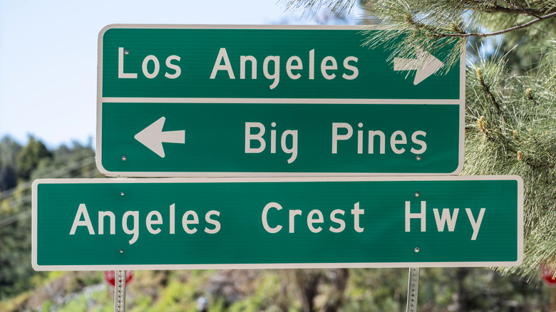
However, as great as the scenic routes just outside the bustling city and through the Golden State's astounding mountains are, they can be rather dangerous. Whether it's Topanga Canyon, Griffith Park, or the Verdugo Mountains, roadways that feature blind turns and narrow lanes can be quite treacherous to navigate, especially if you're not familiar with the area. But if you were to venture more inland and go north on U.S. Route 2 to Angeles Crest Highway, then you would find your way onto both a captivating cruise and one of the most perilous paths through the San Gabriel Mountains. As with many beautiful things in the wild, this route can be incredibly dangerous as well if you're not careful.
On the wings of an Angel(es Crest Highway)
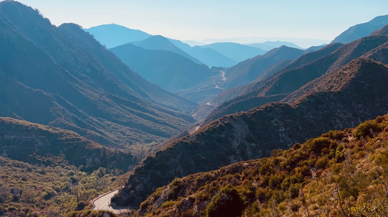
Angeles Crest Highway is a two-lane stretch of road that spans 64 miles of California State Route 2 from La Cañada Flintridge in Los Angeles County to Wrightwood in San Bernardino County. It typically takes around two hours to drive the entire length of the route and the highest point on this course is towards the Dawson Saddle, which will take you almost 8,000 feet above sea level.
But if you need to take a break from driving, you can stretch your legs with a hike. There are many trails in the San Gabriel Mountains National Monument, like the moderately challenging 5.8-mile Waterman Mountain Loop Trail, or the easier 4.3-mile Three Points to Highway 2 Crossing, which is along a section of the Pacific Crest Trail. Whether you choose to navigate the area by car or by foot, you are bound to see some exquisitely serene views of Southern California featuring blue skies, fresh air, and plenty of nature, all practically a stone's throw away from the hustle and bustle Los Angeles' downtown area.
Angel(es) or devil
Like a wild rose bush, the Angeles Crest Highway is alluring yet deadly if you are not paying attention. While the road is in relatively good condition and easy to drive, it's still a two-lane road on the side of the mountains. There are plenty of twists and turns in the road with blind corners where you may not be able to see oncoming traffic. And if you happen to be going too fast, it's possible to lose control and end up in a crash or even accidentally swerve over the edge and plummet off of one of the many steep drops.
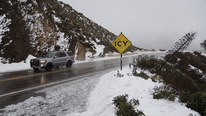
In addition to the treacherous route itself, Mother Nature can also cause major issues for travelers along Angeles Crest. The road is typically closed in winter months from Islip Saddle to Vincent Gap as a precaution from landslide and snow hazards. The California Department of Transportation has also shut down pieces of the highway because of the high risk of wildfires. And most recently, two large stretches were restricted and many residents were forced to evacuate the area due to flooding from the excessive rainfall that Southern California has been experiencing lately.
Overall, reports say that there have been at least 1,800 accidents on Angeles Crest Highway over a five-year period. Out of that number at least 33 were fatal. While a leisurely drive on this scenic road is highly recommended, drivers are encouraged to stay alert and enjoy with caution.