North America Is Home To The World's Longest And Arguably Most Scenic Bike Trail
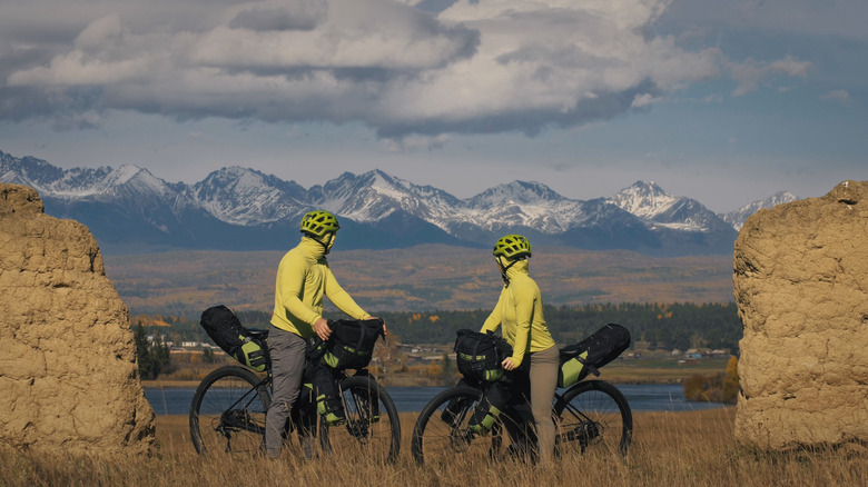
Thanks to its vast and varied wilderness, North America is home to many scenic wonders. From diverse forests and expansive deserts to towering mountains and deep lakes, there are countless ways to experience this bounty of nature. Yet, there is one way unlike any other: The Great Divide Mountain Bike Route (GDMBR), also known as the longest off-pavement cycling route in the world. For those who seek the exhilaration of conquering nature's challenges on two wheels and experience arguably the most beautiful bike trail ever — this is the adventure for you.
Best known for the Tour Divide (an annual mountain biking race), the trail's origins trace back to the Adventure Cycling Association (ACA), which designed and completed the route in 1998 to accommodate a wide range of cyclists. To this day, the ACA supplies riders with comprehensive resources about the route before and during the expedition, including maps, riding conditions, information about nearby towns, services, highlights, and logistics, along with updated corrections.
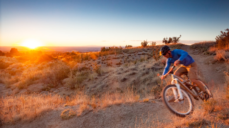
According to the Adventure Cycling Association, the GDMBR spans a whopping 3,086 miles, with only 950 miles (about 30%) of the route paved. The remainder is a blend of terrains such as forest paths, dirt roads, and gravel, thankfully not the most technically challenging rides. However, in some areas, walking with your bike may be necessary. Bikepacking.com, a reputable biking hub, rates the difficulty of this trail at 5.5 out of 10. Nonetheless, cyclists must not take it lightly due to the wide variety of factors they may come across along the long ... long ... way.
The Great Divide Mountain Bike Route
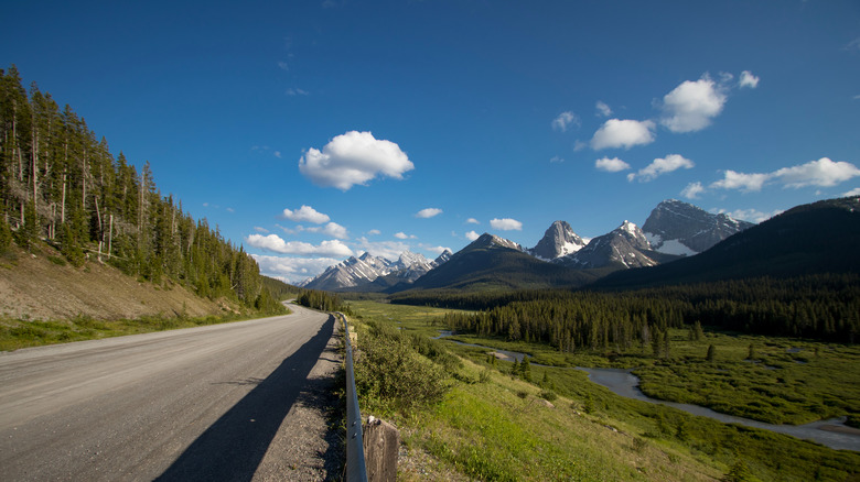
This route begins in Jasper, Canada. Traveling through this region, you'll pass numerous stunning national and provincial parks, including Banff and Elk Lakes. After crossing the Continental Divide — the primary connector of North America's river systems — you'll enter British Columbia. From there, the journey continues down the entire length of the Rocky Mountains, offering unparalleled views along the ridge. The route continues to Helena, Montana, where the trail becomes particularly challenging with mountain ascents and forest paths of Glacier National Park and Bob Marshall Wilderness. Welcome to the United States!
As you briefly pass through Idaho for 76 miles, prepare for the stunning high plains of Wyoming. Furthermore, attractions like Yellowstone and Grand Teton, with their natural springs, provide tempting oases for much-needed rest stops. You'll need these as you approach Colorado's Indiana Pass, the route's high point at 11,910 feet. The ride's rocky terrain really tests your endurance and skill — as to be expected, this is the Rockies, after all.
Before you know it, you'll be entering the dry heat and strong winds of New Mexico. You will pass landmarks like the Polvadera Mesa and the Gila National Forest before hitting nothing but open roads on the final leg of your journey. Here, try to set aside the muscle aches and reflect on your experiences before your adventure concludes at Antelope Wells, New Mexico, at the U.S.-Mexico border.
Tips for your cycling journey
It's worth noting that it takes an average of 37 riding days to complete and can take up to two months — certainly not for the faint of heart (cardio pun intended). With that being said, consider rest days, average distances, daily ascents, etc. This will help prepare you both physically and psychologically for the trip. But you don't have to set a deadline when covering such long distances; give yourself more time than you think you need and plenty of contingency. This isn't a race like the Tour Divide; it's an experience that is yours and yours only. Aside from physically preparing for the ride of a lifetime, it's crucial to take some precautions. In national parks or wilderness zones, you might run into a bear, moose, elk, or mountain lion. Packing protection like bear spray or noisemakers can be a lifesaver.
The optimal time of year to undertake this challenge is in mid-August. This timing helps you avoid the peak rainfall periods across the different locales, and it also coincides with the hunting season, making the route feel less remote. In contrast, setting out in early summer can lead to encounters with more mosquitoes and wet conditions, as snow may still be melting at higher elevations. Lastly, always have your route at the ready; an official map with GPS, points of interest, and trail notes is essential. Think you got what it takes? If not, that's okay — the ACA also offers organized tours if you're not up for the long ride alone.